Fort Myers Beaches are located on Estero Island, just west of the city of Fort Myers. The beaches face San Carlos Bay, which itself is wide open to the Gulf of Mexico. Across the bay you can see Sanibel Island.

The beaches are flat, the sand is white, and the water is shallow, but not super-clear because of the tannin stained rivers emptying into the bay. The water on Fort Myers beaches is some of the calmest and safest Gulf swimming available in Florida.
Traffic congestion is a major problem on Fort Myers Beach and the city is trying to ease the problems by providing off-island parking and trolley service for beachgoers. The greatest congestion is between January and May, especially on weekends.
The northern part of Estero Island in particular has a Key West party atmosphere, while the central and southern portions are mostly residential, with a few tall condominiums and several large resorts on the southern part of the island. All of the public beach accesses are on the northern and central part of the island.
If you're visiting for the day, beach parking can be an issue. But if you're staying in a beach hotel, it's usually not a worry since you're parked at your hotel. The hotels have some pretty awesome beaches. The sand is very white and soft in most places.

Fort Myers Beach has a tremendous amount of accommodations of all types. From hotels, motels, and beach cottages to a few large resorts. There is a tourist shopping district and a large residential area. Despite the heavy development of Estero Island, there is still plenty of tropical greenery so you won't forget you're in the islands of southwest Florida. You might even think you are in Key West. Except that the beaches are much nicer on Fort Myers Beach.
Have a look at the types of beach vacation rentals you'll find on Ft. Myers beach, including one of the places I've stayed..

The public beach access at Lynn Hall Memorial Park, next to the Pelican Pier, can get pretty crowded. In fact, the parking lot normally fills up well before 11 am.
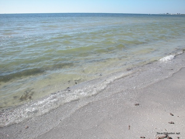
The water on Fort Myers beach is very calm, shallow, and reasonably clear.
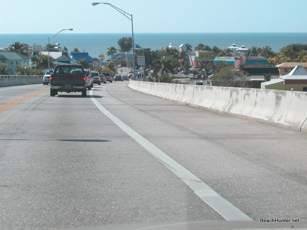
This is what you'll see while driving down off the bridge into the Times Square area of Fort Myers Beach.
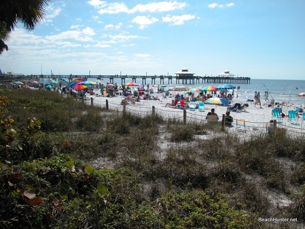
The Pelican Pier as viewed from the public access at Lynn Hall Memorial Park.

The Times Square area next to the pier. Plenty of action here. And plenty of food.
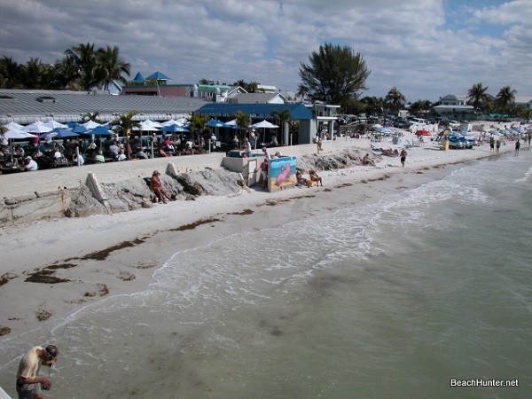
There are plenty of beachfront restaurants and bars near the pier on Fort Myers Beach. Many have open-aire decks overlooking the Gulf.
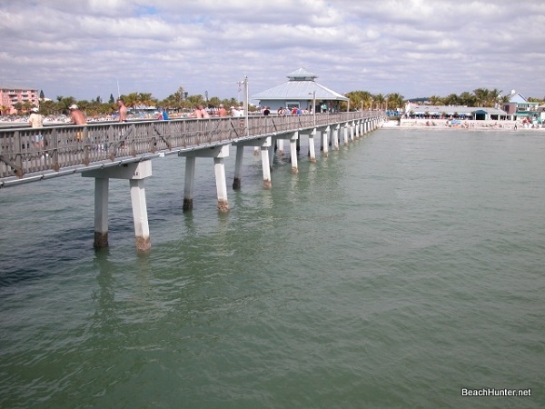
Take a walk out onto the Pelican Pier to get away from the crowd. It's a narrow pier, but extends out into the Gulf for quite a distance. There's a bait and tackle shop in the middle of the pier which also sells snacks and drinks.

Despite the congestion in the Times Square area of FMB, it's not that hard to find a quiet spot near some coconut palms and sand dunes. You can easily walk for miles on this flat beach.
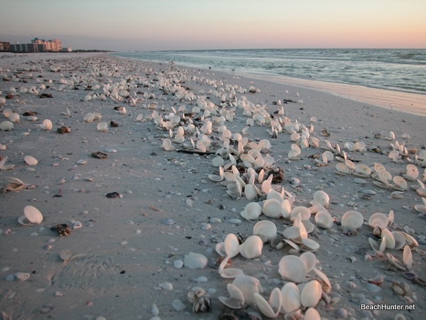
You just never know what you're going to find on the beach. On this evening I found thousands of beautiful Disc Dosinias washed up on the beach. Who knows why.
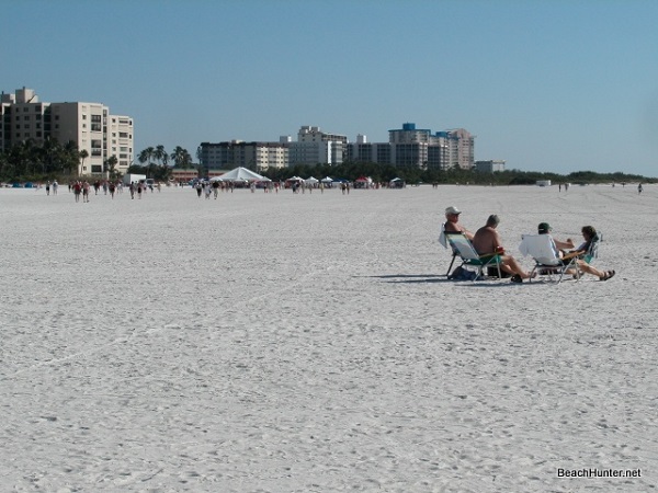
The southern end of Estero Island has a huge white beach.
